Park Street Lane, St Albans, Hertfordshire, AL2 2BG
Site with Residential Development potential subject to planning permission. For Sale by Informal Tender or by a Promotion Agreement.
-
Property specification
- Total site area extends to approximately 2.46 hectares (6.74 acres).
- Adjoining the settlement edge of How Wood, a village excluded from the Green Belt.
- Situated between St Albans to the north and Watford to the south.
- Range of facilities and amenities together with transport links.
- 3 miles from St Albans centre, 2.2 miles from Radlett centre and 4 miles from Watford centre.
- Each of the above has a main line railway stations St Pancras/ Euston.
-
Description
SUMMARY
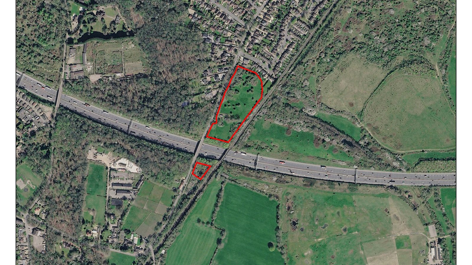
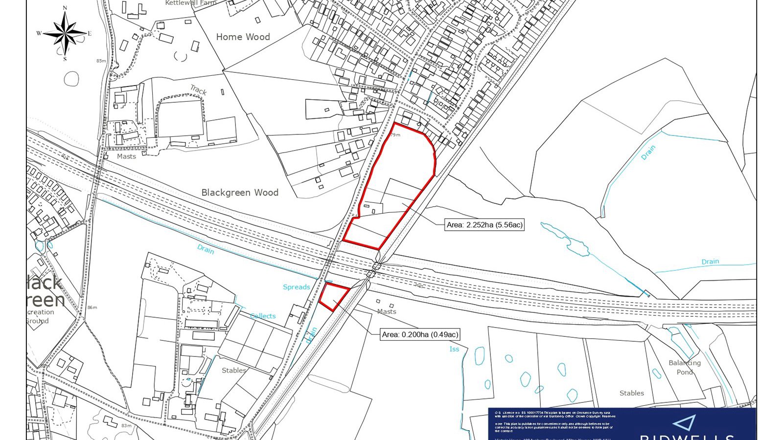
-The total site area is shown edged red and extends to approximately 2.46 hectares (6.74 acres).
-The site adjoins the settlement edge of How Wood, a village excluded from the Green Belt.
-A data room link provides a suite of document extracts, plans and planning summary.
LOCATION
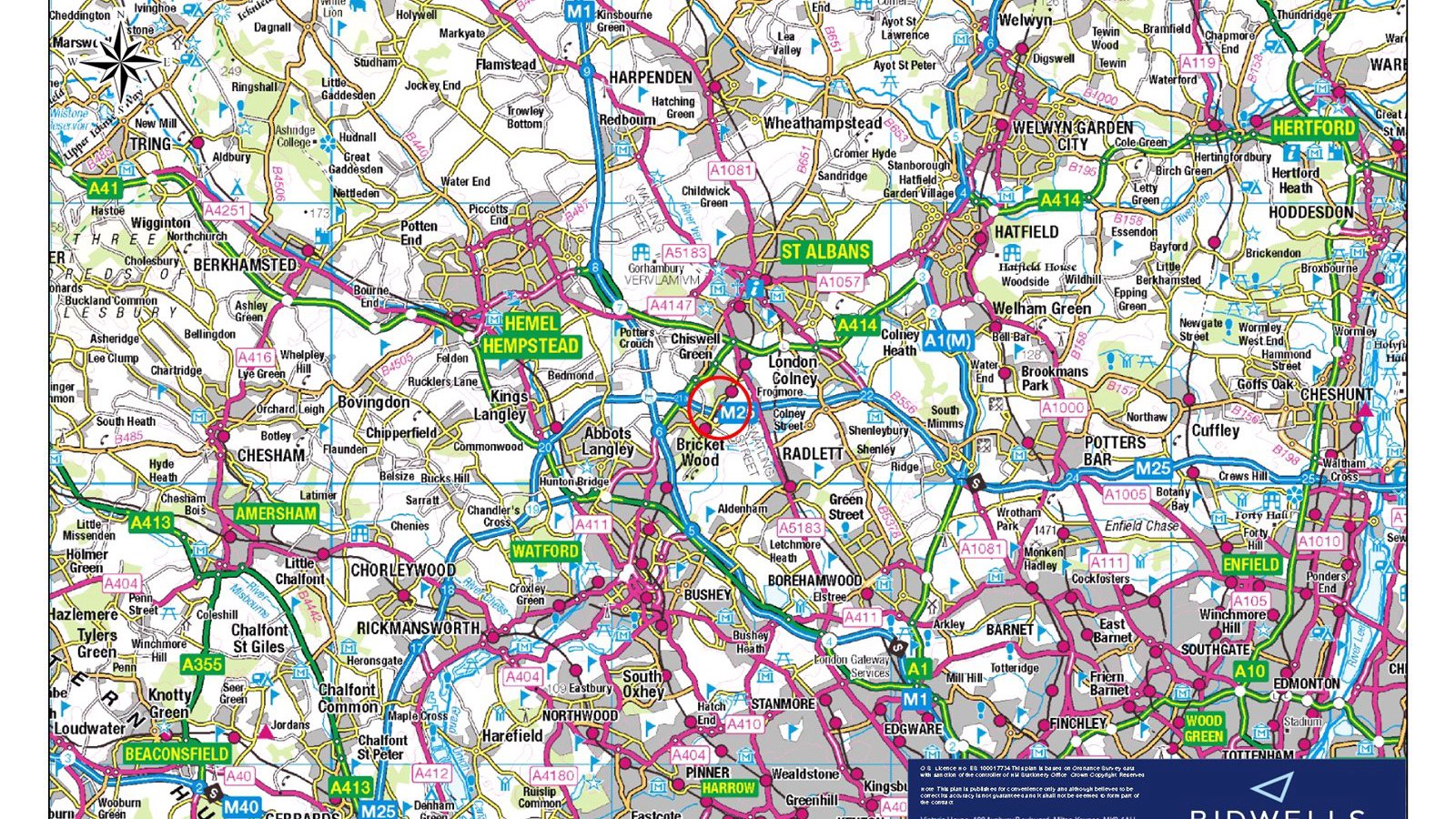
-How Wood is a settlement between St Albans to the north and Watford to the south. It has a range of facilities and amenities together with transport links.
-How Wood is within - St Albans centre, 3 miles (4.5 km), Radlett centre, 2.2 miles (3.6 km), Watford centre 4 miles (6.6 km)
-Each of the above town centres has a main line railway stations St Pancras/ Euston.
-M1/M25 Junction 1.5 miles (2.2 km)
-The site has proximity via footpath access to the following -Neighbourhood centre, 0.9 km, Doctor's surgery, 0.55 km, Primary schools, 1 km, Secondary schools, 3.4 km, Bus stop outside the frontage with services 361 and 635
-Local railway stations (St Albans, Watford, Abbey Flyer) Bricketwood and How Wood, 0.8 km
All distances approximate.
THE SITE
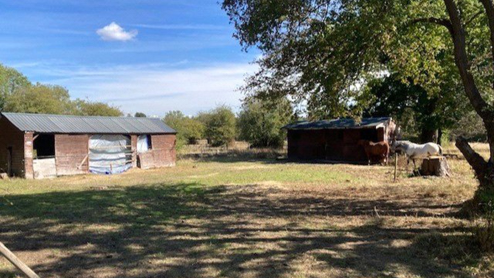
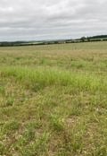
The property is severed by the M25, which is in a cutting. The area of land north of the M25 is approximately 6 acres, and the area south 0.74 acres. This southern area adjoins an existing allotment and in the St Stephen Neighbourhood Plan it makes reference to the provision of additional allotments. The site is generally level and used for equestrian purposes. It fronts Park Street Lane an adopted public highway. Adjacent to the eastern boundary is the local railway line between St Albans and Watford Junction and a high pressure gas main. Beyond the railway line is a restored former waste tip site now used as a public accessible area. Along the southern boundary parallel to the M25 is a high pressure gas main which also crosses the land to the south.
Part of the site is shown on the Environment Agency website as being susceptible to flooding. Research indicates that there is a 9 inch diameter pipe beneath the railway line discharging into the brook. Areas of flooding provide opportunities for Biodiversity Net Gain or potentially to divert water via swales along the eastern boundary to a mitigation pond along the southern boundary and using site excess soil to provide a noise bund.
PLANNING OVERVIEW
The Site is within the Green Belt. The St Albans Local Plan was adopted on the 9 September. The Council are committed to an immediate review of the plan and have already started the process with a “call for sites”. The property has been submitted in the “call for sites”.
The housing provision in the Local Plan was based upon the old Standard Methodology. The new Standard Methodology requires a significant increase in the housing provision which will inevitably require the release of Green Belt.
The purpose of the Local Plan Review is to allocate land to meet the new housing requirements. St Albans Housing Delivery Test is at an estimated 45%.
The planning policies considered at the Local Plan Examination related to the National Planning Policy prior to the changes in December 2024 and the revisions to planning guidance in February 2025. The former introduced Grey Belt and the latter confirmed that for the Green Belt purposes, large settlements were not villages. How Wood is a village in the settlement hierarchy.
The National Planning Policy Framework August 2026 did not change Grey Belt and refers to the tilted balance in favour of sustainable development where the Housing Delivery Test was not met. Within Grey Belt development will be permitted in the Green Belt where there is an unmet development need. We believe there is a strong justification the land should be regarded as Grey Belt.
A summary of the Local Plan history and previous evidence is provided in the Information Pack. This shows the Councils have considered the property for housing in the past. As an edge of village settlement, the site has good proximity to services, amenities and public transport.
There is in our opinion a strong case for a Grey Belt planning application for housing and a robust case the site should be released from the Green Belt as part of the Local plan Review.
LEGAL TITLE
-The site is being marketed subject to and with the benefit of all wayleaves, easements, covenants and rights of way, whether or not disclosed.
-There are no known public rights of way over the site.
-The site is subject to a high pressure gas main, where its diversion was permitted under a temporary agreement when the M25 was constructed. There is no current formal wayleave or easement.
-The agreement in relation to the equestrian occupation is provided in the Information Pack.
VAT
The owners have not elected to charge VAT but reserve the right to opt to tax in relation to a Promotion Agreement.
TENURE AND POSSESSION
In respect of a sale of the property, the freehold interest with vacant possession on completion.
VIEWINGS
The site can be viewed from the public highway. Parties should take all due care for their own personal safety when inspecting the site.
INFORMATION PACK
An information pack is available upon request.
Interested parties will be deemed to have submitted proposals in the full knowledge of all the documents within the information pack. Documents included comprise:
-Legal title
-Grazing Agreement
-Temporary Gas Pipe Agreement and plan from Cadent.
-Submissions to the Reg 19 Local Plan Consultation - This provides a planning summary relating to the Local Plan history with extracts from planning documents.
-Environment Agency Flood Maps Fluvial and Surface Water.
-Overage Heads of Terms in respect of a sale.
-Bid Proforma for a Promotion Agreement.
SALE CONDITIONS
The sale will be subject to an overage provision of 40% of the enhanced value related to a planning change and for a period of 30 years. Details of the overage terms are provided within the information pack.
PROMOTION AGREEMENT
A Bid Pro Forma for completion of an offer in relation to a promotion agreement is provided in the information pack.
OFFERS
Offers for both the purchase and/or the promotion agreement should be clearly set out:
-confirm the information in the data room has been reviewed
-the proposed purchase price or completion of the promotion agreement pro forma
-full details of any conditions attached to the offer
BIDDING PROCESS
The sale and offers under a promotion agreement will be conducted by way of an informal tender. The proposal should be clearly marked ‘Land at Park Street, How Wood’ and should be submitted by e-mail to derek.bromley@bidwells.co.uk by no later than 12 pm on Friday 27th o
Train Stations:
-
Bricket Wood
0.77km
-
How Wood
0.90km
-
Frogmore
1.60km
-
Frogmore
1.60km